Analysis Diagrams:

Diagram 01: Representing the barriers to free movement on and around the site.
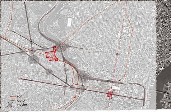
Diagram 02: Analysis of major transportation corridors and areas of congestion. Our site directly borders two congested areas – Girard Ave. at the Schuylkil exit & Girard Ave. at Parkside Ave.

Diagram 03: Analysis of public parks near the site (Drexel park not shown, but is located to the South East of our site)

Diagram 04: Regional Analysis of established corridors. Our site is located near Lancaster Ave, One of the oldest links to the West of Philadelphia.
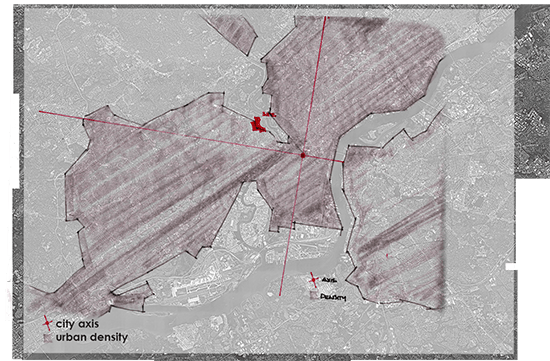
Diagram 05: Regional Analysis of Urban Density. Our site is located on a border between open park space, and highly developed urban development.

Diagram 06: Regional Park (Open Space) and River/stream networks.
